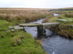
 Fice's Well Clapper Bridge Fice's Well Clapper Bridge
Dartmoor Forest Parish
The Parish of Dartmoor Forest is in central Dartmoor and aligns approximately to the medieval Royal Forest of Dartmoor. The parish is the largest in Devon, stretching from Petre's Cross in the south to Winter Tor in the north; and from Merrivale in the west to Dartsmeet and the Warren House Inn in the east; covering about 56,000 acres. The Parish is divided into three wards that reflect the main settlements: Hexworthy & Huccaby (1 Councillor) Postbridge (2 Councillors) Princetown (7 Councillors) Our terrain includes the largest wilderness in southern England with high moorland, bog and the granite tors for which Dartmoor is famous. We have considerable surviving relics of bronze age settlements and stone rows; the ruins of the tin mines, granite quarries, powder mills and peat works that represent Dartmoor’s industrial past; and of course, the infamous prison . Sheep, cattle and ponies are farmed on the open moor and in the enclosed fields surrounding farmsteads, some of which date from the 12th century. Due to our size and position, we border 23 other parishes. Clockwise from the north these are: Belstone, South Tawton, Throwleigh, Gidleigh, Chagford, North Bovey, Manaton, Widecombe in the Moor, Holne, West Buckfastleigh, Dean Prior, South Brent, Ugborough, Harford, Cornwood, Shaugh Prior, Sheepstor, Walkhampton, Whitchurch, Peter Tavy, Lydford, land common to the parishes of Bridestowe and Sourton, and Okehampton Hamlets. |
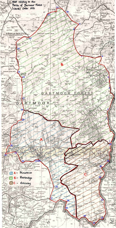
Map of Dartmoor Forest Parish
Based on OS 1:25000 OL28 Map
